We flew into Anchorage on a late-July evening. Our first stop the next morning was at an enormous Cabela’s store to buy red-pepper spray to repel any charging bears we might encounter. There, we met a Massachusetts couple that visits Alaska annually to fish on the Kenai Peninsula, our destination. The couple mesmerized us with tales of frequent black and brown bear (the same species as the grizzly) sightings, making us nervous.
After stocking up on groceries, we headed south toward the Kenai, driving along the spectacular Turnagain Arm of the Cook Inlet, so named because Captain Cook’s ship had to turn around in a futile attempt to find a transcontinental passage. After rounding the end of the Arm, we crossed onto the Kenai Peninsula and entered the Chugach National Forest, America’s northernmost, westernmost, and second-largest national forest. The Chugach covers 5.4 million acres, roughly the size of New Hampshire, and includes lands along Prince William Sound and the Copper River Delta to the east in addition to the eastern Kenai Peninsula. It spans a transition zone between boreal forest and coastal temperate rain forest. Over 25 percent of the forest is covered with snow and ice year round.
As we continued south, we passed through long valleys bounded by steep-sided mountains 5,000 to 6,000 feet tall, topped with bare rock and patches of snow. Lines of dark conifers alternated with green meadows and the occasional turquoise lake. Signs warned of avalanches; undoubtedly, this can be a treacherous drive in winter and spring. The Kenai Mountains receive up to 10 feet of snow annually. Earthquakes are another danger here; the 1964 Good Friday Earthquake raised the forest by 10 feet in minutes and devastated nearby towns. Minor quakes that trigger landslides occur more frequently.
We settled into the cozy cabin we had rented near the village of Moose Pass. That evening, it stayed light until almost 11 p.m. The next morning, we headed out for a day hike in the National Forest to Ptarmigan Lake. We wore the canisters of bear spray in holsters on our belts and hung bells from our packs, which jangled as we walked. (The best way to avoid a bear encounter, we were told, is to make lots of noise; bears don’t like to be surprised and usually try to avoid humans.)
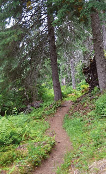
The trail followed the rushing Ptarmigan Creek for the first couple of miles. The creek’s beautiful blue-green color comes from silt originating from alpine glaciers in the mountains above. Fine rock flour resulting from the grinding action of the glaciers is suspended in the water and reflects more of the blue and green end of the spectrum than other colors.
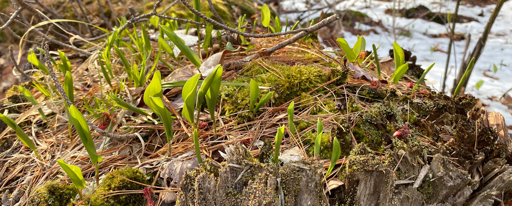
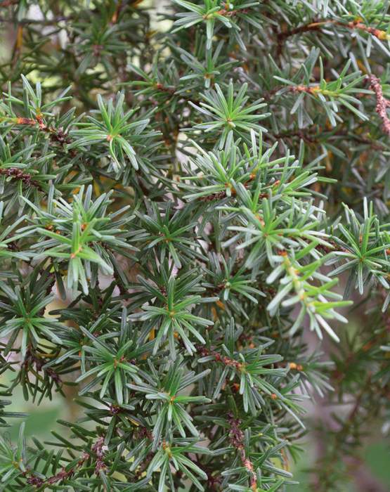
The path wound through a forest of mostly spruce and hemlock, a mix of temperate rain forest (Sitka spruce and mountain hemlock) and boreal forest trees (white spruce). Lutz spruce (a hybrid between Sitka and white) also grows here. Mountain hemlock looks nothing like our eastern hemlock: its needles grow from all sides of the branch in a bottlebrush pattern, and its cones are much larger. We saw only a few deciduous trees, such as Kenai birch and balsam poplar, in sunny places along the stream. On the forest floor grew many familiar plants you might see in a cool, damp northeastern coniferous forest: bunchberry, twinflower, pyrola, and mountain cranberry. A red squirrel chattered from the treetops, and piles of cone scales marked its feeding station on a fallen log.
Finally, we emerged from the forest into an open area thick with tall grasses, cow parsnip, fireweed, and elderberry. This clearing is maintained by avalanches, which periodically rumble down the steep slope that was to our left. Here, we saw fresh bear scat on the trail, and we began making more noise. There were impressive views of the mountains to the west. As we followed the trail along a hillside, we could see Ptarmigan Creek, now far below us. Around the bend, we met a hiker returning from the lake who said he had seen a black bear cross the trail that morning.
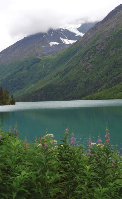
Eventually, we entered the woods again and descended to Ptarmigan Lake, an aquamarine jewel set among snow-capped peaks. The bluish Mother Goose Glacier, the source of the glacial silt that colors the lake, was visible on the side of one peak. In contrast to the Northeast, the landscape here is newer and is still being shaped by glaciers. Unlike our ancient, rounded Appalachians, in south-central Alaska, the peaks tend to be sharp and jagged. Higher places are devoid of trees, even at elevations not necessarily higher than we have at home. The tree line above Ptarmigan Lake, for example, is 1,000 to 1,500 feet.
We weren’t bothered by insects while hiking, but when we stopped for lunch at the lake, a cloud of black flies swarmed around us. Our insect repellant kept them from biting, but they were annoying. Other people were fishing at another spot on the lake; perhaps the bugs wouldn’t be so bad over there. The two couples were friendly, and we chatted with them while we ate lunch. They were from Arizona and spending two months in Alaska, travelling together in two RVs. They were catching Dolly Varden char (named for a female character in a Charles Dickens novel). Ptarmigan Creek, the lake’s outlet stream, hosts Dolly Varden along with rainbow trout, and a spawning run of brilliant-red sockeye salmon returning from the ocean. The abundance of fish is one of the reasons the Kenai Peninsula has so many bears. Though bears are omnivorous and eat vegetation, roots, and berries, fish protein and fat helps them put on weight before hibernation. Bears with access to fish tend to be larger. Sea-run salmon are crucial to the health of the forest as well. Decaying salmon carcasses and scat from animals that feed on them infuse the soil with nutrients.
One of the men at the lake was scanning a rocky crag with binoculars and spotted several moving white dots: Dall sheep or mountain goats (we were not close enough to see the telltale horns). We all had a look at them and marveled at their ability to scramble around on high cliffs. Another fish-lover – a bald eagle – flew in and perched on a dead tree branch overhanging the water.
We had not seen signs of logging in the forest. The Chugach is more of a recreation forest than a timber forest, according to Alicia King, Chugach Public Affairs/Partnership Staff Officer. Trees take years to grow in this climate. Some 96 percent of the forest is managed to allow natural ecological processes to occur with limited human influence, and over one-third of the forest is a wilderness study area. A small amount of sawtimber and firewood is harvested commercially, and firewood, Christmas trees, and cabin logs are cut for personal use by local residents, including native peoples. A Lutz spruce from the Chugach was the national Christmas tree a few years ago. Commercial and subsistence harvesting of other forest products such as cones, berries, mushrooms, and medicinal plants also takes place.
On our return hike, I found a few clumps of soft, woolly black hair, probably the underfur from the bear that had crossed the path that morning, and my husband saw a ptarmigan scurry across the trail.